
AMTA · Getting around Andorra
Andorra map and route planner
One destination, several ways to get there. Find your way around Andorra by bus, on foot, by car or with a driver. AMTA brings together places and useful information to help you plan your journey.
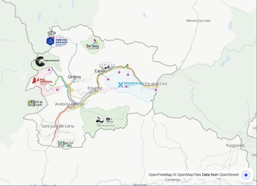 Open the AMTA map
How do you get around Andorra?
Choose according to your destination, departure time and how far you want to walk.
What is AMTA?
AMTA stands for Accés, Mobilitat, Transport, Andorra. Its map brings together places, restaurants, shops, services and events across the country, with information to help you plan your journeys.
Search for an address or place, open its page and plan your route. Browse bus lines and stops, compare the options offered and find parking or a fuel station before setting off.
Your route in three steps
Find your destination
Search for a place, address, restaurant or event on the AMTA map.
Choose your starting point
Enter your starting point or use your position if you allow location access.
Compare and go
View the available options, check departure times and open the journey that suits you.
01
By bus
Plan a public transport journey by choosing your start and destination in AMTA. Check the lines, direction, boarding and alighting stops, connections and suggested walking sections.
For trips to Encamp, Canillo, La Massana, Ordino or Sant Julià de Lòria, check the relevant line and departures for your travel day. Scheduled times and real-time estimates, where available, can change: check your return journey too.
02
Taxis and Uber
To book a taxi, contact a dispatch centre or use its app. Taxi Andorra offers booking by phone, WhatsApp and app. Provide your pickup address, destination, passenger count and any particular requirements.
Uber also lists a service in Andorra la Vella. Check its app for available vehicles, your pickup point and the offered price. If AMTA displays a provider link, booking and payment are completed with that provider; confirm availability and the fare before booking.
03
On foot
Find your destination and view the walking route suggested by AMTA. Walking can be a practical way to connect shops, restaurants and sights in central Andorra la Vella and Escaldes-Engordany, or reach a bus stop.
Consider the gradient, weather and accessible crossings. A short distance on the map may involve a climb. For mountain outings, plan a hiking route suited to the conditions and your ability.
04
By car
Choose your destination on the map, find nearby parking and check fuel stations along the way. The driving navigation options available in AMTA let you continue guidance in the suggested app.
Before heading to a valley, ski resort or Pas de la Casa, check traffic conditions on Mobilitat. Allow extra time for traffic, parking and, in winter, weather conditions.
Frequently asked questions
Open the AMTA map, search for your destination and enter your starting point. View the suggested journeys and choose according to the available modes, duration, connections and walking sections.
You can combine buses between towns, walking for nearby destinations and a taxi or chauffeur service subject to availability. Check service to your destination and the last return departure.
AMTA displays the information available for lines and stops. A scheduled time is not a real-time estimate. When a real-time estimate is available, check its label and look again before setting off.
Uber lists an offer in Andorra la Vella on its website. Check the Uber app for availability at your address and time, and for the price. An advertised service does not guarantee a vehicle for every journey.
AMTA helps you plan your journey and may offer links to external services depending on the available options. Booking, confirmation and payment take place directly with your chosen provider.
Find your destination and parking, check fuel stations if needed and review traffic conditions on Mobilitat. Then open the driving navigation option available for your journey.
Your next journey starts here.
A place to discover, a bus to catch or an outing to organise: open the map and plan your journey.
Open the AMTA map